Some 266 Polynesian Islanders live atop a “pie crust”
reef that rests on a long-extinct volcano. Their 40-mile-long strip circles a
90 square mile lagoon (compare Oregon’s Crater Lake at 20 square miles). The
Penrhyn Atoll, aka Tongareva, lies
south of the equator and is the outermost part of the Cook Islands (see map in
Scott #63, above). Total land area is 3.8 square miles. Its nearest neighbor is 220 miles to the
southwest. Ships pass by rarely. Air transport is unscheduled and
unpredictable.
Stamps were issued for Penrhyn Island two times in
their history. From 1902 to 1920 stamps of New Zealand were overprinted for
Penrhyn, followed by stamps like those of the Cook Islands but with “Penrhyn”
inscribed, 1920 to 1932. In all, Scott list 31 major numbers while Stanley
Gibbons counts 40. BB provides spaces for 19.
Then, from 1973 to the present, Penrhyn stamps were
again issued, this time with the additional inscription “Northern Cook
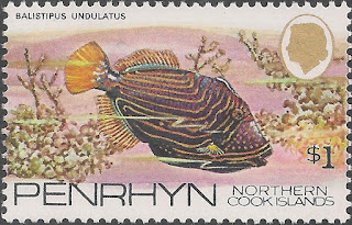
Islands.” Recent issues have attracted a following of bird and fish topical
collectors. Penrhyn Atoll has few terrestrial flora and fauna.
Remoteness and population decline have severely
limited Penrhyn’s postal services. Today’s population is almost half what it
was when the stamps in Big Blue were in use. Authentic cancellations,
therefore, cost more than mint examples. Philatelically inspired cancels are
commonly pinked on more populous islands.
My collection is entirely mint. There is no Penrhyn
supplement page.
Census: 19 in BB spaces.


Thank you Bud for your excellent overview of Penrhyn Island. Personally, I enjoy learning more about these remote stamp issuing entities. In fact, I went out my to acquire a postally used Sc 8 and modern cover with a CDS "PENRHYN, NORTHERN COOK ISLANDS". Fun!
ReplyDeleteEnjoy. #8 is attractive even though the mountains seem incongruous for Penrhyn, which rises short of five meters altitude.
ReplyDelete